Product Overview
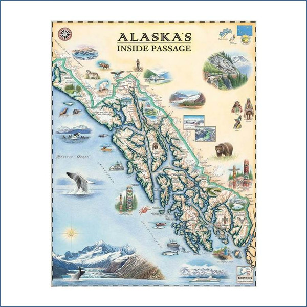
Alaska’s Inside Passage is a region of pristine water, snow-capped mountains, deep fjords and forested islands that extend approximately 500 miles (800 km) from north to south and 100 miles (160 km) from east to west and encompass more than 1,000 islands, 15,000 miles (24,000 km) of shoreline and thousands of coves and bays. Its mountains are carpeted with majestic western hemlock and giant Sitka spruce forests. Shaped by the staggering force of massive glaciers millions of years ago, Alaska’s Inside Passage is home to Tlingit, Haida and Tsimshian Indians whose history and culture is reflected in many small coastal communities throughout the region. It’s also prime habitat for bald eagles, sea lions, porpoises, whales and many other mammals that attract visitors from around the world; most of whom experience this amazing landscape on cruise ships, ferries, water taxis, sea kayaks and float planes. The Inside Passage Map is 18" wide x 24" tall.
The medium used by world-renowned illustrator Chris Robitaille for these hand-drawn maps is pen & ink with multiple layers of watercolor washes. Depending on the depth of detail in the map being rendered, the actual art process takes anywhere from 5-8 weeks.
The end result is an entirely custom, unique and original piece of art that has been fully vetted for "educational merit, historical and geographic accuracy and cultural relevance.
All Xplorer Maps lithographic maps are printed on heavy-duty, 80 lb. cover stock using only soy-based inks and 50% post-consumer product. The medium for Giclee prints is 100% cotton, MUSEO MAX, heavy rag with absolutely no optical brighteners. These giclee prints represent the finest original artwork reproduction in the industry and will appreciate in value approximately 5% annually for a true investment in art.


